Day 1 and 2- 1-6 and 1-7
Unit 4- Political Organization of Space- African Countries Geographic Challenges
Thursday and Friday-
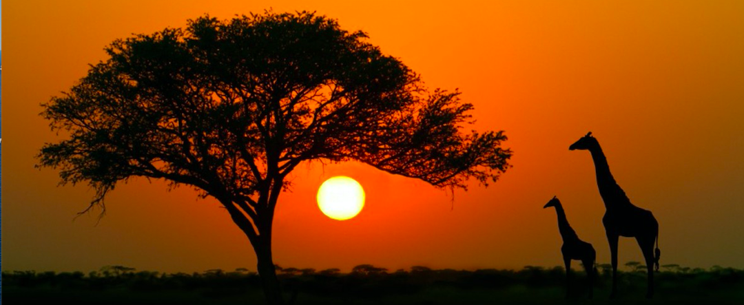
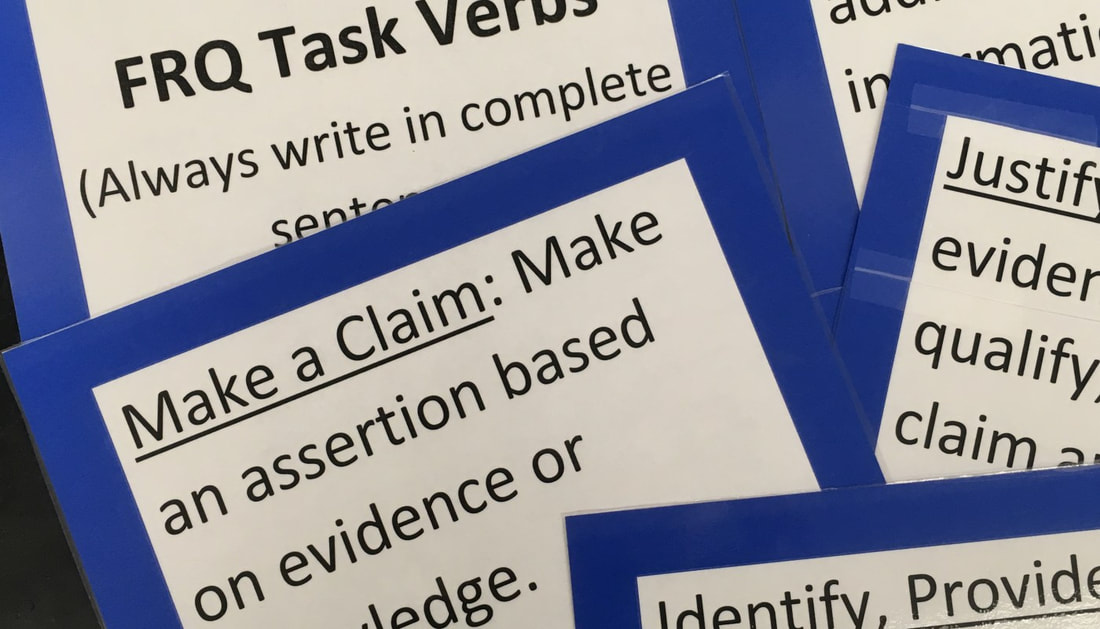
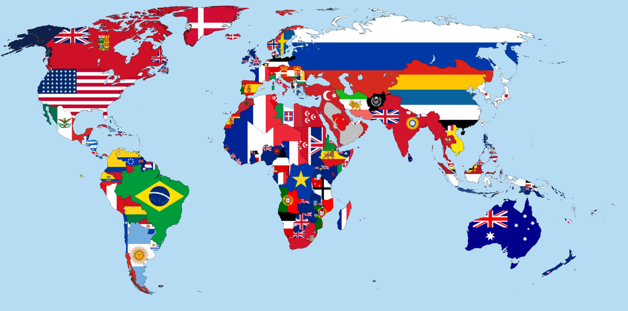
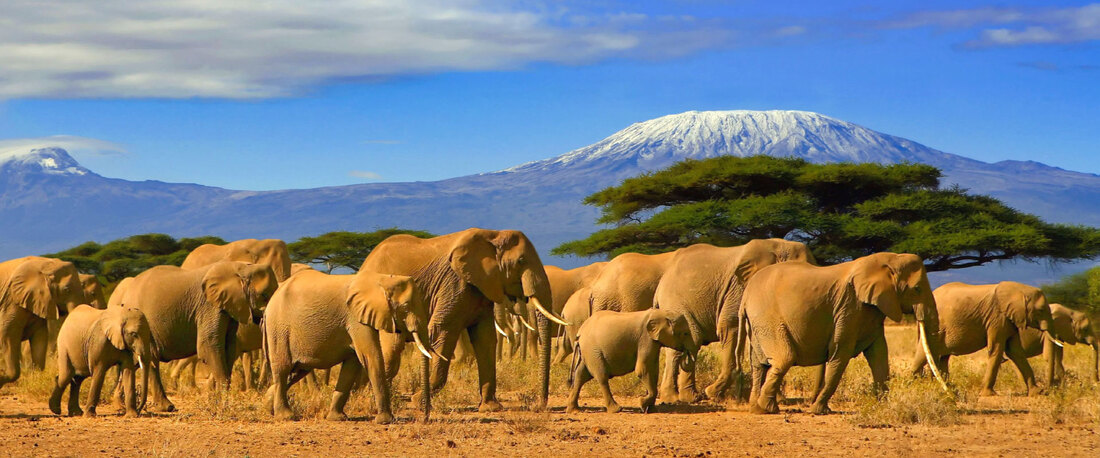
We are going to look at the political use of space in this unit. Our focus area for this topic will be the continent of Africa. We will explore the countries, regions and physical features of the continent.
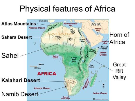
Physical Features you should know-
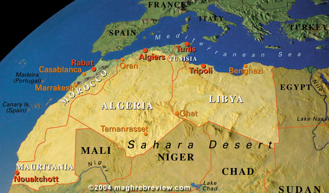
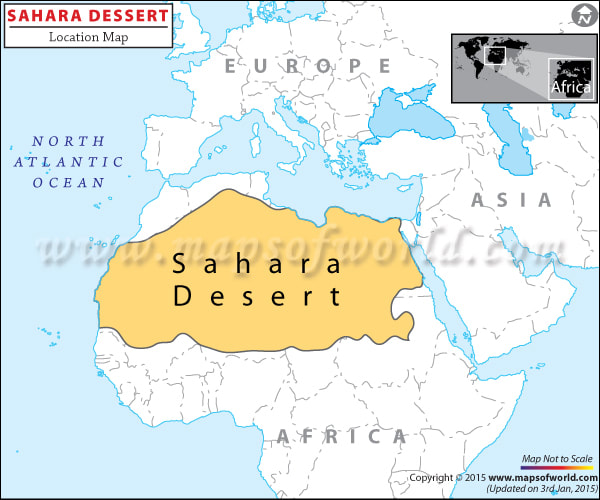
Sahara Desert
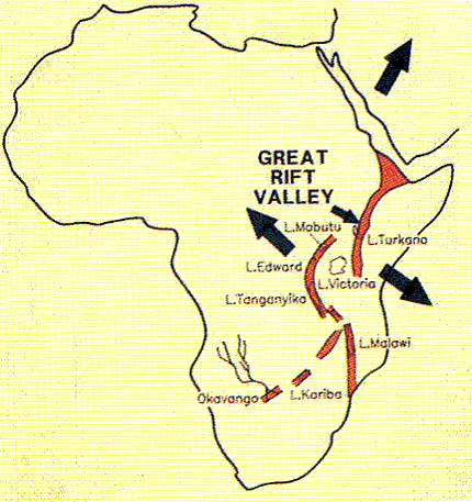
Great Rift Valley
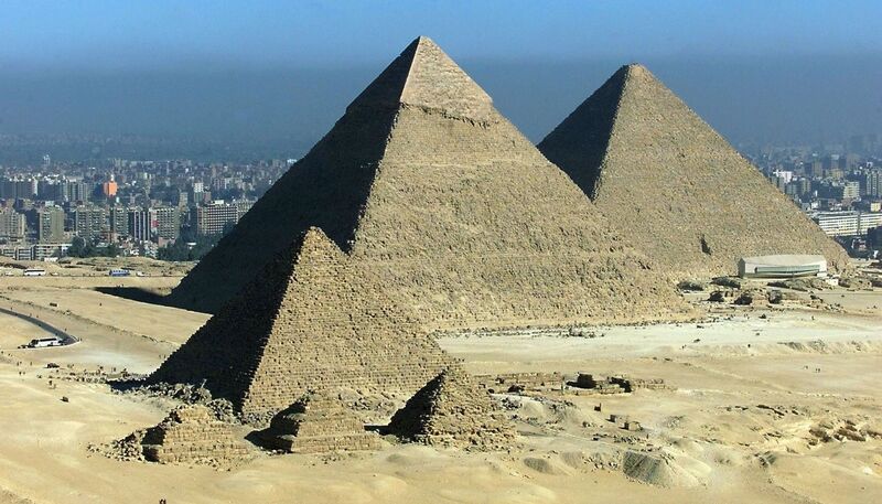
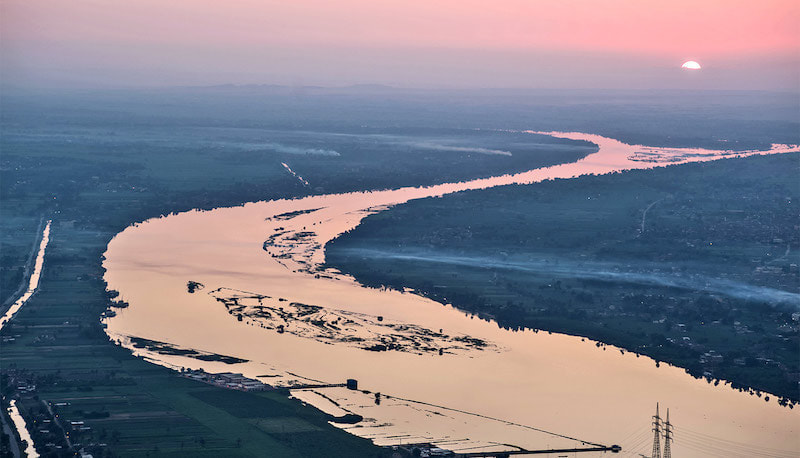
Nile River- Blue Nile and White Nile
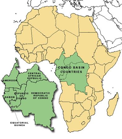
Congo River Basin
The Sahel
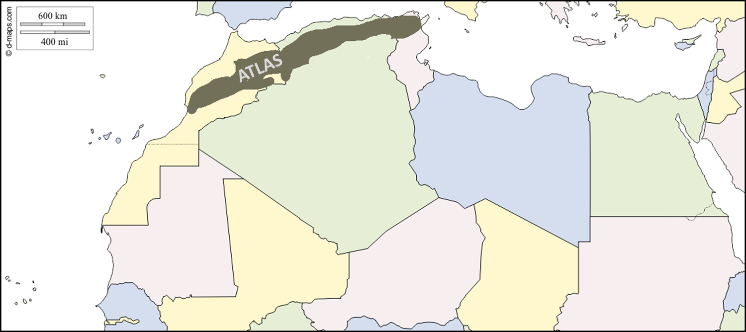
The Atlas Mountains
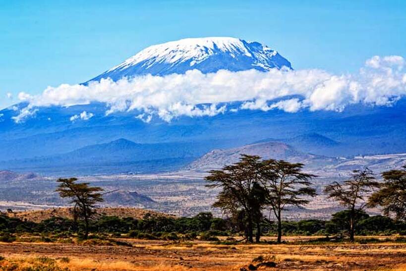
Mount Kilimanjaro
The Maghreb
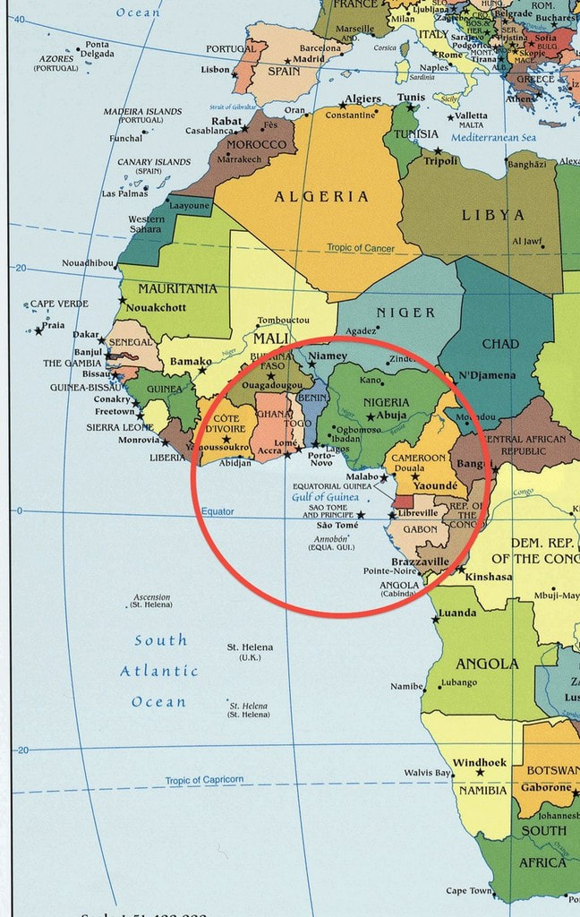
Gulf of Guinea
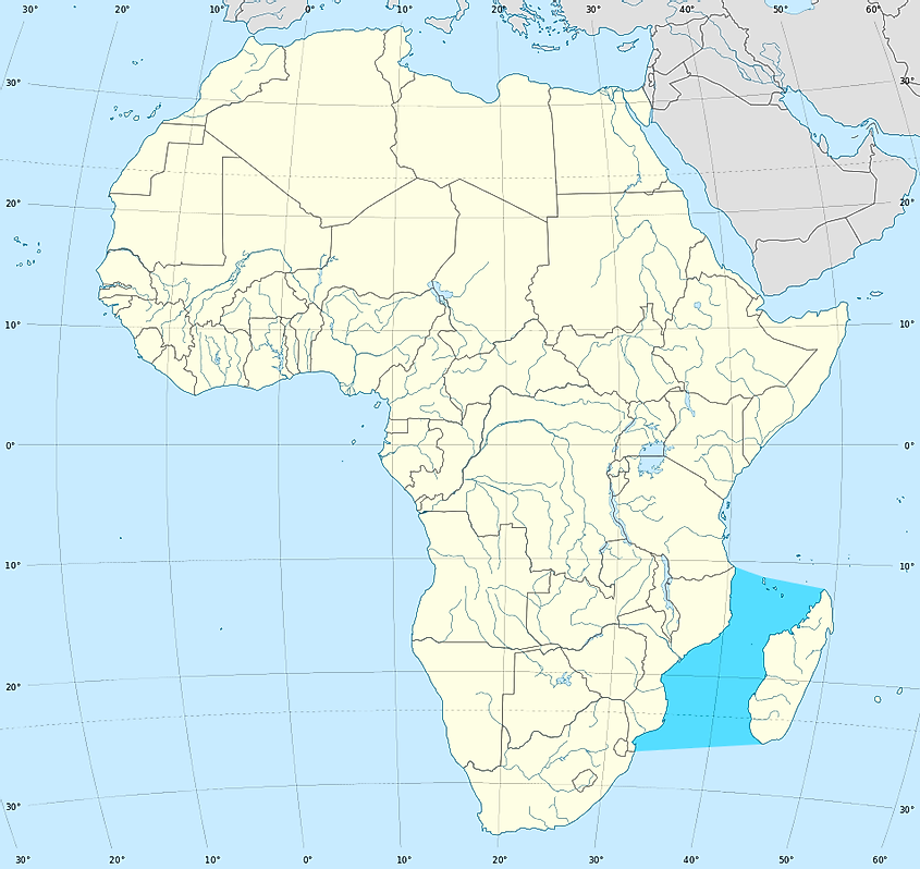
Mozambique Channel
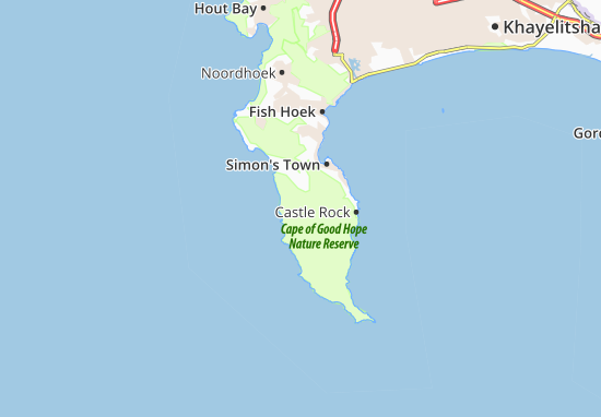
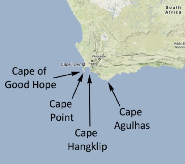
Cape of Good Hope
Below you will find links to the "Geographic Challenges" several African countries. You will need to write down at least two things that you learned from each link on a piece of paper and turn it in to your teacher for points.
Physical Features you should know-
Sahara Desert
Great Rift Valley
Nile River- Blue Nile and White Nile
Congo River Basin
The Sahel
The Atlas Mountains
Mount Kilimanjaro
The Maghreb
Gulf of Guinea
Mozambique Channel
Cape of Good Hope
Below you will find links to the "Geographic Challenges" several African countries. You will need to write down at least two things that you learned from each link on a piece of paper and turn it in to your teacher for points.
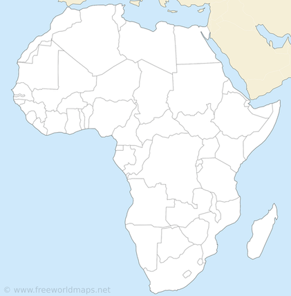
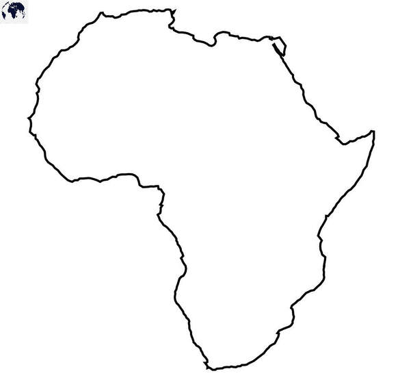
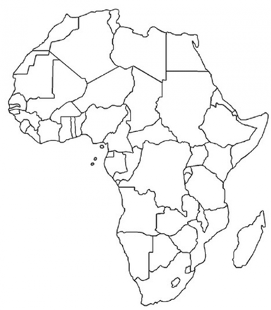
On Friday we will work on a coloring map of Africa after we complete a top 11 physical feature and region map of Africa
|
|
Top Ten (11) Physical Features / Regions
Day 3- 1-10-22
Topic 4.1- Political Organization and Geography
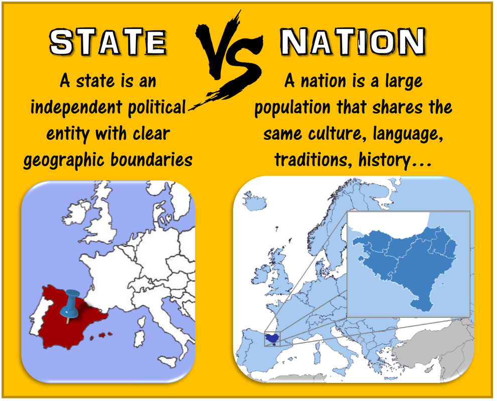
Question to Ponder- When is a state not a state but a nation is a state? 1-10-22
Today we are going to jump right into Unit 4- Political Organization of Space. We will start with some basic terms such as nation and state through the eyes of a human geographer. After we talk about a few basic terms we will start reading Chapter 8 pages 191-212 of the blue AMSCO book and complete the questions on pages 213-215 by start of class Thursday.
Questions to Ponder-
1. When is a state not a state but a nation is a state?
2. What are the requirements to be officially recognized as a state?
3. What are some of the key factors that determine if a group of people are a nation?
4. and finally what on earth is a stateless nation????????
Terms You Need To Know-
State
Nation
Nation-State
Multi-National States
Autonomous Regions
Semi-Autonomous Regions
Stateless Nation
Multi-State Nation
|
|
Day 4- 1-11-22
Topics 4.2 & 4.3-. (Make sure you watch all of the clips if you are not at school today) 1-11-22
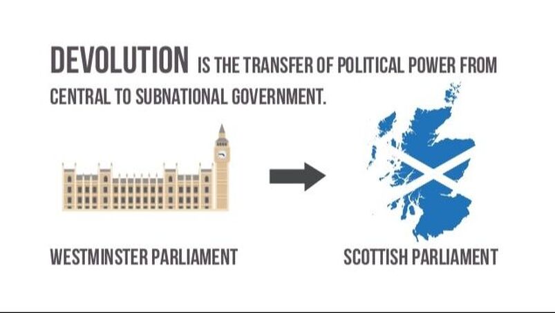
Topic 4.2-What does Colonialism, Imperialism and Devolution have to do with State building?
Yesterday we looked at the difference between the definitions of "state" and "nation" through the eyes of a human geographer. States have 1- a defined boundary, 2- a permanent population, 3- maintains sovereignty over domestic and international affairs and 4- is recognized by other states. Nations on the other hand- 1. share a common cultural heritage, 2, have beliefs and values that unify them, 3. claim a particular space base on tradition as their homeland and 4- desire to establish their own state or express self-determination in some way.
Todays Questions to Ponder-
1. What were the positive and negative impacts of Colonialism and Imperialism?
2. What is meant by Devolution and Balkanization?
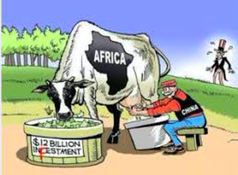
3. What is China current relationship with some African countries?
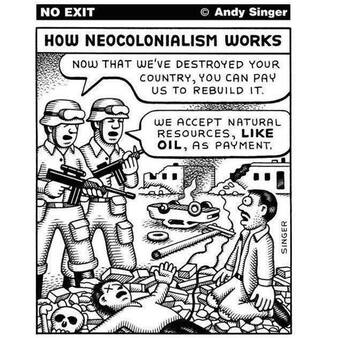
4. What is Neo Colonialism?
5. What is a Choke point?
6. What are some of the impacts of neocolonialism and some of the challenges a that some African countries face today
Terms- Shatterbelt, Cultural Shatterbelt, Choke points, Territoriality, neocolonialism, colonialism, Imperialism, Berlin Conference, genocide, satellite states, Cold War, centripetal force, centrifugal force, nationalism, geopolitics,
Todays Questions to Ponder-
1. What were the positive and negative impacts of Colonialism and Imperialism?
2. What is meant by Devolution and Balkanization?
3. What is China current relationship with some African countries?
4. What is Neo Colonialism?
5. What is a Choke point?
6. What are some of the impacts of neocolonialism and some of the challenges a that some African countries face today
Terms- Shatterbelt, Cultural Shatterbelt, Choke points, Territoriality, neocolonialism, colonialism, Imperialism, Berlin Conference, genocide, satellite states, Cold War, centripetal force, centrifugal force, nationalism, geopolitics,
|
|
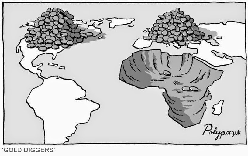
Topic 4.3- Neocolonialism, Africa and more----
Key Question- What is neocolonialism and how is it visible in the world today?
REMEMBER CHAPTER 8 QUESTIONS ARE DUE ON THURSDAY THIS WEEK!
|
|
Day 5- 1-13-22
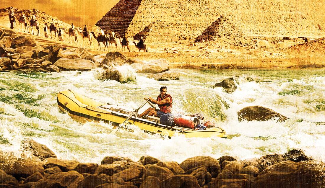
Quiz Day Chapter 8 and the Blue Nile.
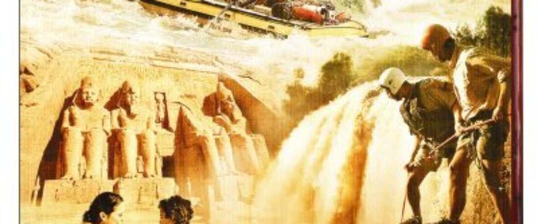
Today we will take the chapter 8 quiz- Today we are watching the film- "The Mystery of the Nile". I have sent out an email that contains questions for the film- Please answer these and reply to the email at the end of class- here are the questions-
5th hour class will do the Zello activities!
5th hour class will do the Zello activities!

Film Guide- Mystery of the Nile Name __________
Class- World Geography Date ________
Instructor- Platt Hour ________
1. What is the World’s longest river?
a. the Blue Nile
b. the Amazon
c. the Nile
d. The Mississippi
2. The Nile gave life to one of the world’s first great civilizations- which one?
a. Egyptians
b. Roman
c. Aztec
d. Greek
3. What is the true source of the Nile?
a. Lake Victoria
b. Mt Everest
c. Lake Tana
d. The sacred spring at Sakala, the highlands of Ethiopia
4. Some of the dangers that the team encountered included?
a. crocodiles
b. Hippopatamos
c. bandits
d. all of the above
5. In the city of Lalibela, what were carved into the solid rock?
a. pyramids
b. churches
c. burial chambers
d. none of the above
6. In the film we discover that 90% of the forests in the Ethiopian Highlands were lost in the last thirty years- why?
a. trees were killed by a disease
b. the nile flooded and washed away the trees
c. trees were cut down to make charcoal for cooking fuel
d. an extreme drought killed the trees
7. What does the team check for before going to sleep next to the river?
a. that they are not camped too close to the edge of the cliff
b. they do a head count to make sure everyone is still present
c. for crocodiles
d. for mosquitoes
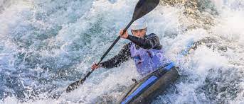
8. Pasquale was afraid of a raft flipping over in the white water because of the risk of …
a. crocodiles
b. drowning
c. getting hit by a rock or caught underwater
d. all of the above
9. When an area to be flooded to create Lake Nasser, an ancient temple built by the Egyptian Pharaoh Rames the Great, was going to disappear beneath the water what did the government do?
a. they changed the location of Lake Nasser to save the site
b. they cut the huge temple apart and moved it to higher ground
c. they took pictures of the temple so the people could remember it
d. they brought submarines so people could still visit the site
10. Who created the first accurate calendar?
a. Egyptians
b. Greeks
c. Romans under Caesar
d. British in 1720
Class- World Geography Date ________
Instructor- Platt Hour ________
1. What is the World’s longest river?
a. the Blue Nile
b. the Amazon
c. the Nile
d. The Mississippi
2. The Nile gave life to one of the world’s first great civilizations- which one?
a. Egyptians
b. Roman
c. Aztec
d. Greek
3. What is the true source of the Nile?
a. Lake Victoria
b. Mt Everest
c. Lake Tana
d. The sacred spring at Sakala, the highlands of Ethiopia
4. Some of the dangers that the team encountered included?
a. crocodiles
b. Hippopatamos
c. bandits
d. all of the above
5. In the city of Lalibela, what were carved into the solid rock?
a. pyramids
b. churches
c. burial chambers
d. none of the above
6. In the film we discover that 90% of the forests in the Ethiopian Highlands were lost in the last thirty years- why?
a. trees were killed by a disease
b. the nile flooded and washed away the trees
c. trees were cut down to make charcoal for cooking fuel
d. an extreme drought killed the trees
7. What does the team check for before going to sleep next to the river?
a. that they are not camped too close to the edge of the cliff
b. they do a head count to make sure everyone is still present
c. for crocodiles
d. for mosquitoes
8. Pasquale was afraid of a raft flipping over in the white water because of the risk of …
a. crocodiles
b. drowning
c. getting hit by a rock or caught underwater
d. all of the above
9. When an area to be flooded to create Lake Nasser, an ancient temple built by the Egyptian Pharaoh Rames the Great, was going to disappear beneath the water what did the government do?
a. they changed the location of Lake Nasser to save the site
b. they cut the huge temple apart and moved it to higher ground
c. they took pictures of the temple so the people could remember it
d. they brought submarines so people could still visit the site
10. Who created the first accurate calendar?
a. Egyptians
b. Greeks
c. Romans under Caesar
d. British in 1720
Day 6- 1-14-22. (Friday)
Topic- African Web Search Day
Today we will spend the class exploring a number of links on both cultural and physical traits of the African Continent.
You will get a copy of the questions below in class. Follow the button to the links page.
You will get a copy of the questions below in class. Follow the button to the links page.
Assignment- Africa Web Search Name _________________
Class- World Geography Hour __________
Teacher- Platt Date _________________
Directions- Go to Platt’s website and look under Africa Links on his World Geography page and answer the following questions.
1. Go to Nile river facts and list five things you learned from this site
a. _________________________________________________________________
b. _________________________________________________________________
c. _________________________________________________________________
d. _________________________________________________________________
e. _________________________________________________________________
2. Go to the link link- Nile fact file- Answer this question: Why does the Nile flow North?
3. Go to the link on the Sudd- What is the Sudd?
List three interesting things you learned about it:
a. ________________________________________________________________________
b. ________________________________________________________________________
c. ________________________________________________________________________
4. Go to the link on Virunga National Park Who and when was the park created: _______________
List two interesting facts
a. __________________________________________________________
b. _________________________________________________________
5. What are the South African flying sharks? Why do they fly?
6. Who is Jane Goodall?
7. What is the Gombe?
8. What type of slave trade exists in Mali today?
9. Why is the Church of St. Mary of Zion considered sacred?
What is the “ark of the Covenant”?
10. List Three interesting things about Timbutu:
a. _________________________________________________________________________
b. _________________________________________________________________________
c. _________________________________________________________________________
11. List three things of interest of St. Catherine’s Monastery near Mont Sinai:
a. ____________________________________________________________________________
b. ____________________________________________________________________________
c. ____________________________________________________________________________
12. What is the Great Zimbabwe?
13. List your favorite five facts on Mount Kilimanjaro:
a. ______________________________________________________________________________
b. ______________________________________________________________________________
c. ______________________________________________________________________________
d. ______________________________________________________________________________
e. ______________________________________________________________________________
14. What is the Serengeti:
List two facts _a. _________________________________________________________________
b. _________________________________________________________________
15. What is the Maasai Mara:
List two facts a. __________________________________________________________________
b. ___________________________________________________________________
16. What is the Great Rift Valley-:
List two facts a. ____________________________________________________________________
b. ____________________________________________________________________
17. What are the mountains of the moon:
List two facts a. ____________________________________________________________________
b. ____________________________________________________________________
18. What are the atlas mountains:
List two facts a. ____________________________________________________________________
b. ____________________________________________________________________
19. List four interesting facts about the Sahara desert:
a. _______________________________________________________________________
b. _______________________________________________________________________
c. _______________________________________________________________________
d. _______________________________________________________________________
20. Describe the Maghreb:
21. Describe the Sahel
22. Describe the Drakesberg Escarpment:
23. Describe the Kalahari desert:
24. Describe the Cape of Good Hope:
25. Describe the Skeleton Coast:
26. List Three interesting things about the Namib
a. ______________________________________________________________
b. ______________________________________________________________
c. _______________________________________________________________
27. What is Apartheid:
List three interesting facts that relate to Apartheid
a. _____________________________________________________________
b. _____________________________________________________________
c. _____________________________________________________________
28. List three things you liked about Nelson Mandella
a. _________________________________________________________________
b. _________________________________________________________________
c. _________________________________________________________________
29. What is the truth and Recouncilation commision :
30. Who is Hector Peterson_
31. What happened the day he died?
32. What is the Okavango Delta:
List two facts_
a. ___________________________________________________________________
b. ____________________________________________________________________
33. Describe the Tsodilo Hills Rock Art:
Day 7- 1-18-22 (Tuesday)
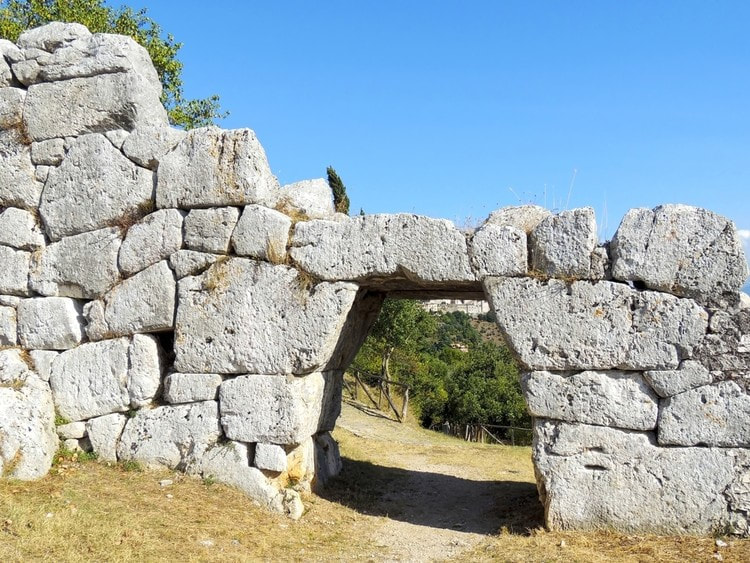
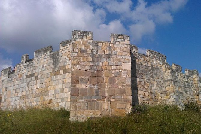
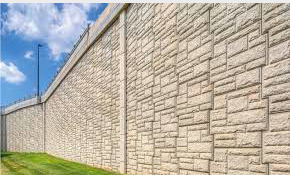
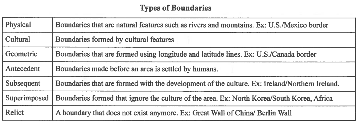
Topic 4.4- Defining Political Boundaries 1-18-22
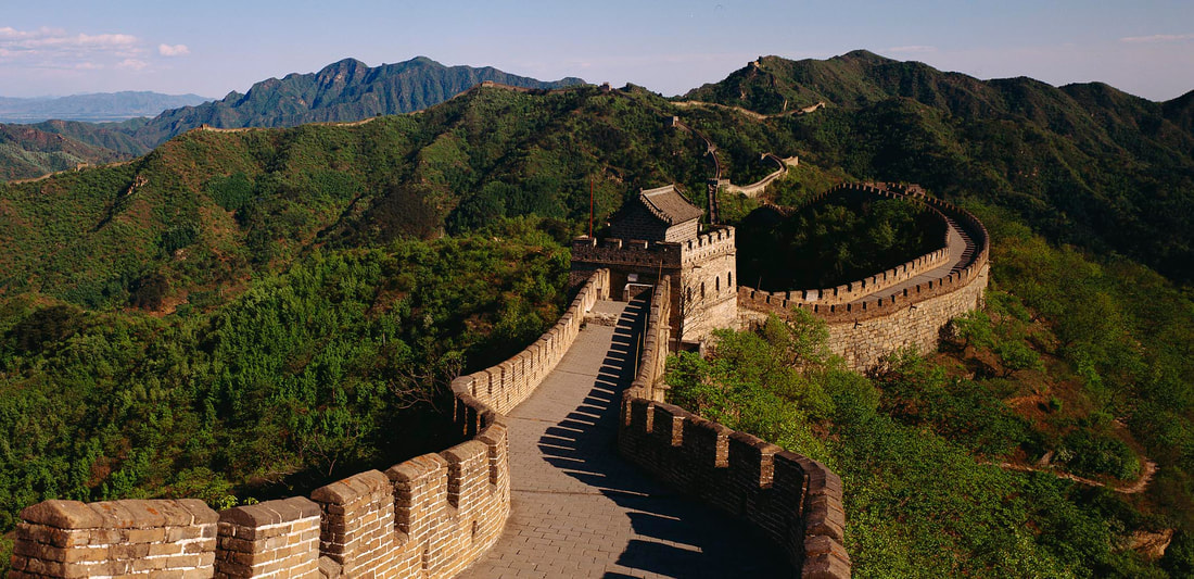
Today we are going to look at types of boundaries in Human Geography. My images show human made barriers such as the Great Wall. We use barriers and boundaries at the personal level (think scale) as well with our fences, gates and personal space as well- So think of these concepts and how they can relate to various scales- We will also look at the geographic challenges that African countries face. You will need to reply to an email sent and write down two things that you learned from each of the clips we look at this morning relating to Africa.
Today's Questions to Ponder-
1. What are some of the different classifications of boundaries in Human Geography?
2. What is a good example of a cultural boundary?
3. What are some types of physical features that might / can serve as boundaries?
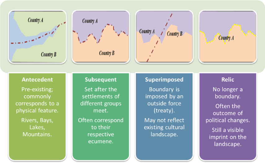
4. What would be an example of a relic boundary?
Terms- MDC, LDC, cultural boundaries, natural (physical) boundary, geometric boundary, antecedent boundary, relic boundary, superimposed boundary, consequent boundary, cultural consequent boundary, physical consequent boundary, open boundary, militarized boundary, frontier, subsequent boundary, Berlin Conference,
Today's Questions to Ponder-
1. What are some of the different classifications of boundaries in Human Geography?
2. What is a good example of a cultural boundary?
3. What are some types of physical features that might / can serve as boundaries?
4. What would be an example of a relic boundary?
Terms- MDC, LDC, cultural boundaries, natural (physical) boundary, geometric boundary, antecedent boundary, relic boundary, superimposed boundary, consequent boundary, cultural consequent boundary, physical consequent boundary, open boundary, militarized boundary, frontier, subsequent boundary, Berlin Conference,
Day 8- 1-20-22. ( A Triple Play Day or as Pizza Shuttle might Say a Three-Fer)
Block Day Topics- 4.5.What are the Functions of Political Boundaries, 4.6 Internal Boundaries, and 4.7 Forms of Governance
Today- We are first going to look at the functions of Boundaries.
Questions to Ponder over 4.5
1. What are some of the ways boundaries can be defined?
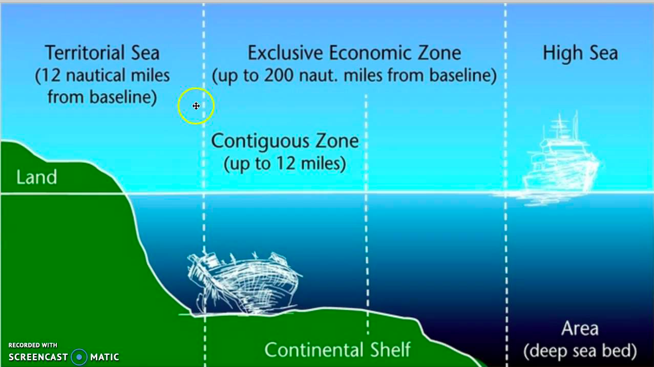
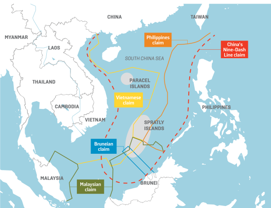
2. What is the Law of the Sea?
3. What are some of the effects of boundaries?
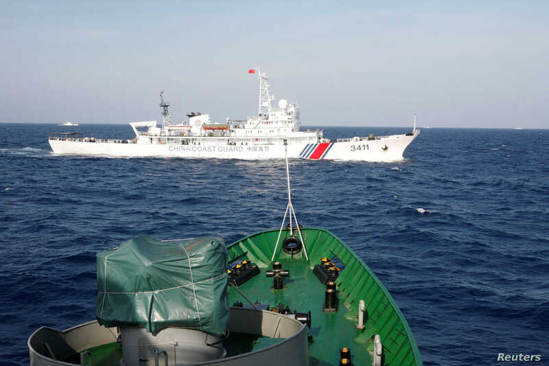
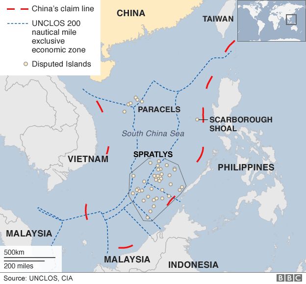
Terms for 4.5. Law of the Sea, South China Sea, allocation boundary dispute, operational boundary dispute, location boundary dispute, definitional boundary dispute, strait of Malacca and the nine dash line
Questions to Ponder over 4.5
1. What are some of the ways boundaries can be defined?
2. What is the Law of the Sea?
3. What are some of the effects of boundaries?
Terms for 4.5. Law of the Sea, South China Sea, allocation boundary dispute, operational boundary dispute, location boundary dispute, definitional boundary dispute, strait of Malacca and the nine dash line
4.6 What in the heck is gerrymandering and what does it have to do with boundaries?
Questions to Ponder for 4.6
1. What is meant by "electoral geography"?
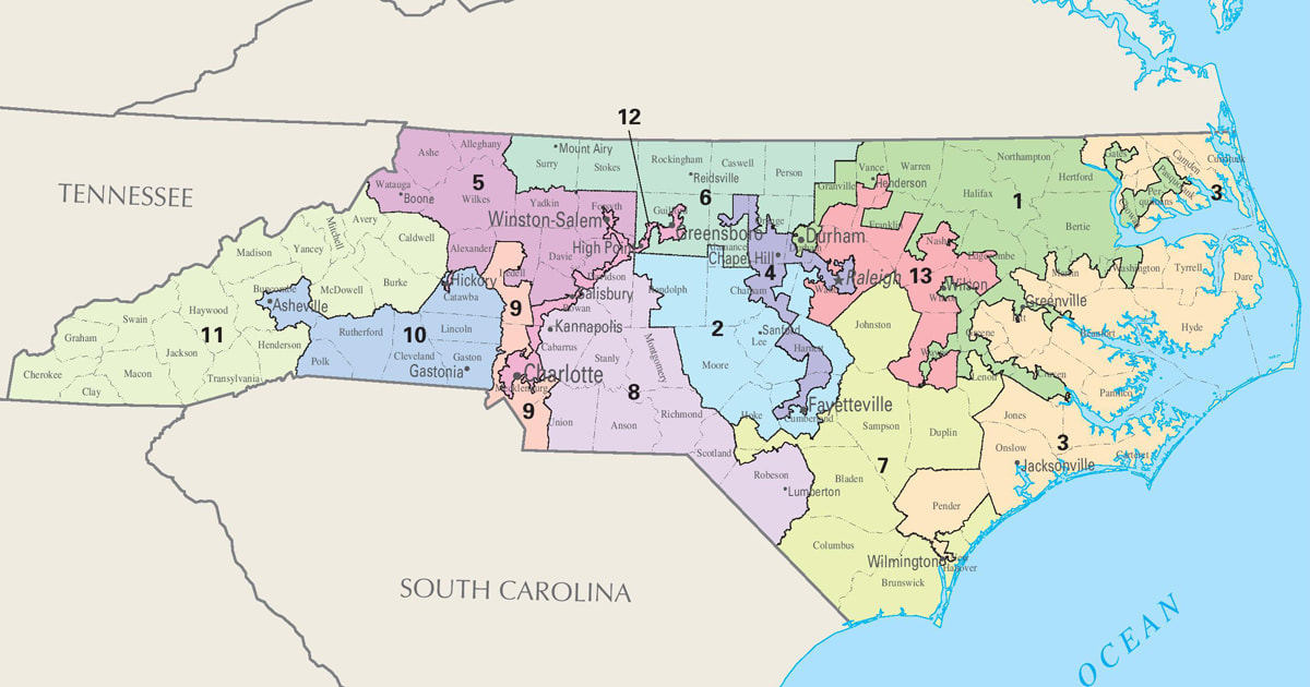
2. What is gerrymandering?
3. What are some of the different types of gerrymandering?
Terms for 4.6- voting districts, census, gerrymandering, redistricting, cracking, packing, kidnapping, Hijacking, stacking and safe districts
1. What is meant by "electoral geography"?
2. What is gerrymandering?
3. What are some of the different types of gerrymandering?
Terms for 4.6- voting districts, census, gerrymandering, redistricting, cracking, packing, kidnapping, Hijacking, stacking and safe districts
4.7 What are the Different forms of Government We See Around the World?
Questions to Ponder of 4.7
1. What is a Unitary State as compared to a Federal State?
2. How do local powers vary bu the government type?
3. What does annexation mean?
Terms for 4.7- federal state, unitary state, annexation
1. What is a Unitary State as compared to a Federal State?
2. How do local powers vary bu the government type?
3. What does annexation mean?
Terms for 4.7- federal state, unitary state, annexation
Assignment- Today we will work on our first of two Unit 4 One Pagers- You will receive the directions in class as seen below. You will need to have at least 5 illustrations to be integrated into this one pager.
Day 9- 1-21-22. Mount Kilimanjaro and Quiz Day for Chapter 9
Today You will get the Chapter 9 quiz- You will have five minutes to complete it
We are also going to watch the film Kilimanjaro to continue our exploration of the African Landmass. Here are the questions that go along with this film-
Film Guide- Mt Kilimanjaro Name __________
The Roof of Africa Hour ______
World Geography- Platt Date _________
1. Kilimanjaro, the highest freestanding mountain in the world, towers how many feet?
a. 22,852
b. 19,340
c. 8,925
d. 14,552
2. Of the 15,000 approximate people who try to climb Mount Kilimanjaro annually, what percentage reach the summit?
a. 10%
b. 25%
c. 50%
d. 75%
3. How many different climate zones and ecosystems would one travel through while climbing to Kilimajaro’s summit?
a. 3
b. 4
c. 5
d. 6
4. True or False - Scientists predict that by the year 2020 the glaciers atop Mount Kilimajaro will double in size
5. Each different climate zone on Mount Kilimanjaro is approximately how many feet high?
a. 1,500
b. 3,000
c. 5,000
d. 6,000
6. What is the most common illness a trekker may experience while climbing Mount Kilimanjaro?
a. motion sickness
b. allegies
c. sunstroke
d. altitude sickness
7. True or False - Due to Kilimajaro’s lush climate zones, plant and animal life is visible all the way to the summit.
8. How many dormant volcanes make up Mount Kilimanjaro?
a. 1
b. 2
c. 3
d. 4
9. True or False - Mount Kilimanjaro, which lies along the great rift valley near the equator, is visible from the moon?
10. Where is Mount Kilimanjaro located?
a. Tanzania
b. Uganda
c. Mozambique
d. Zambia
Day 10- Topic 4.8. Devolution Factors and Power 1-24-22
Today- we talk about Devolutionary forces and the impact of power distribution.
Questions to Ponder
1. What is devolution again?
2.. What are the factors that lead to the devolution of states?
3. What role does irredentism play in devolution?
Terms and concepts- Devolution, terrorism, ethnic separation, ethnic cleansing.
When finished with the Sinn video we will watch Parag Khanna's Ted Talk on the future of countries with consideration to mapping and boarders. You will keep an ESPN sheet on the Ted Talk looking at the economic, social, political and environmental impacts of Parag's talk,
Day 11- Topic 4.9 Challenges to Sovereignty and What is so Super about a Supranational Organization ? 1-25-21
Today we will look at 4.9 "Challenges to Sovereignty" and what this means in regards to real life political situations.
Questions to Ponder-
1. What is sovereignty?
2. What impacts can technology have on a states sovereignty?
3. What impacts does globalization and supranationalism have on a states sovereignty?
Terms-
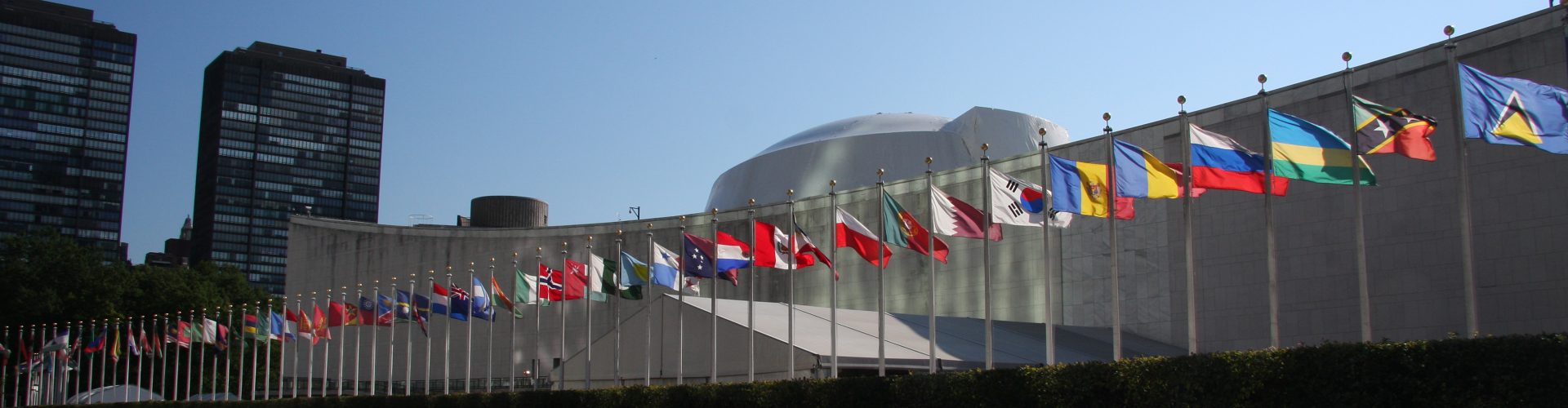
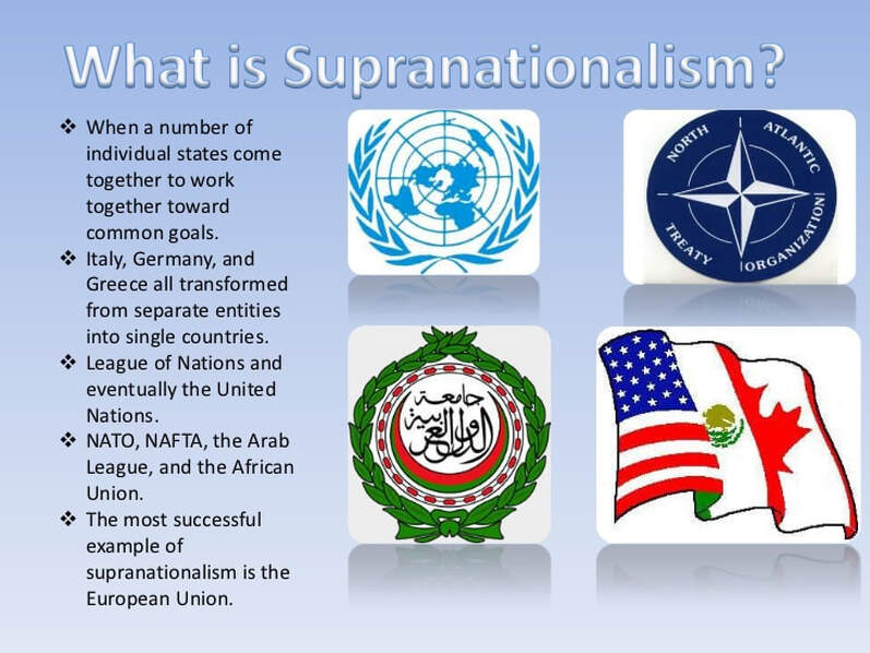
autonomous regions, subnationalism, balkanization, globalization, supranationalism, United Nations, North Atlantic Treaty Organization, European Union, United Sates-Mexico-Canada Agreement, Association of Southeast Asian Nations, Arctic Council, African Union, World Trade Organization, Organization of Petroleum Exporting Nations, transnational corporations, democratization, time-space compression,
Questions to Ponder-
1. What is sovereignty?
2. What impacts can technology have on a states sovereignty?
3. What impacts does globalization and supranationalism have on a states sovereignty?
Terms-
autonomous regions, subnationalism, balkanization, globalization, supranationalism, United Nations, North Atlantic Treaty Organization, European Union, United Sates-Mexico-Canada Agreement, Association of Southeast Asian Nations, Arctic Council, African Union, World Trade Organization, Organization of Petroleum Exporting Nations, transnational corporations, democratization, time-space compression,

Here is our vocabulary list for Unit 4 You will need to create a google slide show for this vocabulary list- One slide for each word and definition plus an image/chart/graphic that illustrates the concept
Annexation—incorporation of a territory into another geo-political entity
Apartheid—a social policy of racial segregation involving political, economic and legal discrimination against non-whites in South Africa
Balkanization—process by which a state breaks down through conflicts among its ethnicities; term comes from the name of the Balkan Peninsula, which was divided into several small nations in the early 20th century
Boundaries- invisible lines that mark the extent of a state's territory and the control that its leaders have.
Buffer state—territorial cushion that keeps rivals apart
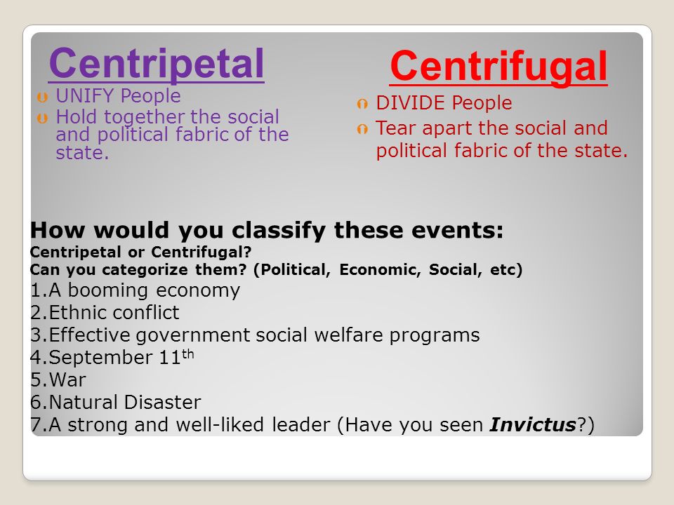
Centrifugal forces—forces that divide a state (force the nation apart)
Centripetal forces—forces that unite a state (pull the nation together)
Choke point- is a narrow, strategic passageway to another place through which it is difficult to pass.
City-state—a sovereign state consisting of a single city and its dependent territories
Colonialism—the attempt by a country to establish settlements and impose political and economic control and principles
Conference of Berlin (1884)—regulated trade and colonization in Africa by the major powers of Europe at the time (Britain, France, Germany, Belgium, Spain, Portugal, Italy)
Core/Periphery—Core countries are countries with high levels of development, a capacity for innovation, and a convergence of trade flows; the periphery is made up of countries with lower levels of development and less wealth than the core countries
Demarcated boundaries- physical objects (like a fence or a wall) mark the boundary
Devolution--two meanings: the transfer of powers and responsibilities from the federal government to the states; the break-up of a country into smaller units based on ethnic groups
EEZ (Exclusive Economic Zone)—generally a state’s EEZ extends to a distance of 200 nautical miles (370 km) out from its coast; the exception to this rule occurs when EEZs overlap (state coastal baselines are less than 400 nautical miles apart) then it is up to the states to delineate the actual boundary; usually any point within an overlapping area defaults to the most proximate state
Enclave—a small and relatively homogeneous group or region surrounded by a larger and different group or region or wholly lying within the boundaries of another country
Ethnic Cleansing- the central state ay attack ethnic groups and eliminate them or expel them from the country.
Exclave— an exclave is a part of a country that is separated from the rest of the country and surrounded by foreign territory
Federal state- power is held by regional units and a central power.
Unitary state- the central government holds the power and creates internal regions to help carry out its plans- the smaller divisions have some degree of power but the central government is the supreme authority.
Forward capital—a symbolically relocated capital city usually because of either economic or strategic reasons
Frontier—a zone where no state exercises complete political control;
Geopolitics/Organic Theory—the state’s power to control space or territory and shape the foreign policy of individual states and international political relations; Freidrich Ratzel’s organic theory: the state acts as a living organism that needs to consume other territories to survive
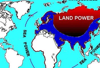
Heartland/Rimland—the Heartland is the part of a region considered essential to the viability and survival of the whole, esp. a central land area relatively invulnerable to attack and capable of economic and political self-sufficiency; the Rimland is the land, often islands and coastal plains around the edge of an area; the area outside the zone of political power
Irredentism- attempting to acquire territories in neighboring states inhabited by people of the same nation.
Landlocked states- those states lacking ocean frontage and are surrounded by other states which gives them a disadvantage to trade, resources (fish), transportation, and communication.
Law of the Sea- Rules established by the United Nations determining territorial waters and EEZs
Rimland Theory—theory of Nicholas Spykman (countering the Mackinder’s Heartland Theory) that claimed that the domination of the coastal fringes of Eurasia (the rimland) would provide the base for world conquest (not the heartland)
State—politically organized territory administered by a sovereign government with a permanent population and recognized by the international community
Sovereignty- the ability of a state to carry out actions or policies within its borders independently from the interference either from the inside or the outside.
Supranational Organization.- is an alliance of three or more states that work together in pursuit of common goals
Nation—population bound by a sense of common identity
Multicore state: a state that has more than one dominant region in terms of economics or politics; the core of a state is the largest population cluster, the most productive region, and the area with the greatest centrality and accessibility
Multinational state: country with two or more nationalities within its borders
Multistate nation: nation that transcends the borders or two or more states
Peace of Westphalia—a number of treaties signed by many European states in 1648 which established the modern state system defined by sovereign states with specific borders instead of Empires
Political Geography- the study of the political organization of the planet- from the beginning of history humans have divided their living space into political units or territories.
Primate city- the largest chitin a country which far exceeds the next city in population, size and importance.
Gerrymander—to divide a geographic area into voting districts so as to give unfair advantage to one party in elections
Shatterbelt—a region caught between stronger colliding external cultural-political forces, under persistent stress, and often fragmented by aggressive rivals
Stateless Nation- describes a people united by culture, language, history, and tradition but not possessing a state.
Suffrage—the right to vote
Territoriality- attempt by an individual or group to affect, influence, or control people, phenomena and relationships by delisting and asserting control over a geographic area.
Types of Boundaries- Antecedent, subsequent, consequent, superimposed, geometric, and relics
UN- United Nations
NATO- North Atlantic Treaty Organization
EU- European Union
USMCA- United States, Mexico, and Canada Agreement
ASEAN- Association of Southeast Asian Countries
WTO- World Trade Organization
OPEC- Organization of Petroleum Exporting Countries
Annexation—incorporation of a territory into another geo-political entity
Apartheid—a social policy of racial segregation involving political, economic and legal discrimination against non-whites in South Africa
Balkanization—process by which a state breaks down through conflicts among its ethnicities; term comes from the name of the Balkan Peninsula, which was divided into several small nations in the early 20th century
Boundaries- invisible lines that mark the extent of a state's territory and the control that its leaders have.
Buffer state—territorial cushion that keeps rivals apart
Centrifugal forces—forces that divide a state (force the nation apart)
Centripetal forces—forces that unite a state (pull the nation together)
Choke point- is a narrow, strategic passageway to another place through which it is difficult to pass.
City-state—a sovereign state consisting of a single city and its dependent territories
Colonialism—the attempt by a country to establish settlements and impose political and economic control and principles
Conference of Berlin (1884)—regulated trade and colonization in Africa by the major powers of Europe at the time (Britain, France, Germany, Belgium, Spain, Portugal, Italy)
Core/Periphery—Core countries are countries with high levels of development, a capacity for innovation, and a convergence of trade flows; the periphery is made up of countries with lower levels of development and less wealth than the core countries
Demarcated boundaries- physical objects (like a fence or a wall) mark the boundary
Devolution--two meanings: the transfer of powers and responsibilities from the federal government to the states; the break-up of a country into smaller units based on ethnic groups
EEZ (Exclusive Economic Zone)—generally a state’s EEZ extends to a distance of 200 nautical miles (370 km) out from its coast; the exception to this rule occurs when EEZs overlap (state coastal baselines are less than 400 nautical miles apart) then it is up to the states to delineate the actual boundary; usually any point within an overlapping area defaults to the most proximate state
Enclave—a small and relatively homogeneous group or region surrounded by a larger and different group or region or wholly lying within the boundaries of another country
Ethnic Cleansing- the central state ay attack ethnic groups and eliminate them or expel them from the country.
Exclave— an exclave is a part of a country that is separated from the rest of the country and surrounded by foreign territory
Federal state- power is held by regional units and a central power.
Unitary state- the central government holds the power and creates internal regions to help carry out its plans- the smaller divisions have some degree of power but the central government is the supreme authority.
Forward capital—a symbolically relocated capital city usually because of either economic or strategic reasons
Frontier—a zone where no state exercises complete political control;
Geopolitics/Organic Theory—the state’s power to control space or territory and shape the foreign policy of individual states and international political relations; Freidrich Ratzel’s organic theory: the state acts as a living organism that needs to consume other territories to survive
Heartland/Rimland—the Heartland is the part of a region considered essential to the viability and survival of the whole, esp. a central land area relatively invulnerable to attack and capable of economic and political self-sufficiency; the Rimland is the land, often islands and coastal plains around the edge of an area; the area outside the zone of political power
Irredentism- attempting to acquire territories in neighboring states inhabited by people of the same nation.
Landlocked states- those states lacking ocean frontage and are surrounded by other states which gives them a disadvantage to trade, resources (fish), transportation, and communication.
Law of the Sea- Rules established by the United Nations determining territorial waters and EEZs
Rimland Theory—theory of Nicholas Spykman (countering the Mackinder’s Heartland Theory) that claimed that the domination of the coastal fringes of Eurasia (the rimland) would provide the base for world conquest (not the heartland)
State—politically organized territory administered by a sovereign government with a permanent population and recognized by the international community
Sovereignty- the ability of a state to carry out actions or policies within its borders independently from the interference either from the inside or the outside.
Supranational Organization.- is an alliance of three or more states that work together in pursuit of common goals
Nation—population bound by a sense of common identity
Multicore state: a state that has more than one dominant region in terms of economics or politics; the core of a state is the largest population cluster, the most productive region, and the area with the greatest centrality and accessibility
Multinational state: country with two or more nationalities within its borders
Multistate nation: nation that transcends the borders or two or more states
Peace of Westphalia—a number of treaties signed by many European states in 1648 which established the modern state system defined by sovereign states with specific borders instead of Empires
Political Geography- the study of the political organization of the planet- from the beginning of history humans have divided their living space into political units or territories.
Primate city- the largest chitin a country which far exceeds the next city in population, size and importance.
Gerrymander—to divide a geographic area into voting districts so as to give unfair advantage to one party in elections
Shatterbelt—a region caught between stronger colliding external cultural-political forces, under persistent stress, and often fragmented by aggressive rivals
Stateless Nation- describes a people united by culture, language, history, and tradition but not possessing a state.
Suffrage—the right to vote
Territoriality- attempt by an individual or group to affect, influence, or control people, phenomena and relationships by delisting and asserting control over a geographic area.
Types of Boundaries- Antecedent, subsequent, consequent, superimposed, geometric, and relics
UN- United Nations
NATO- North Atlantic Treaty Organization
EU- European Union
USMCA- United States, Mexico, and Canada Agreement
ASEAN- Association of Southeast Asian Countries
WTO- World Trade Organization
OPEC- Organization of Petroleum Exporting Countries
Day 12- Topic 2.10 What are centrifugal and centripetal forces and the consequences of such forces on States? 1-27-22
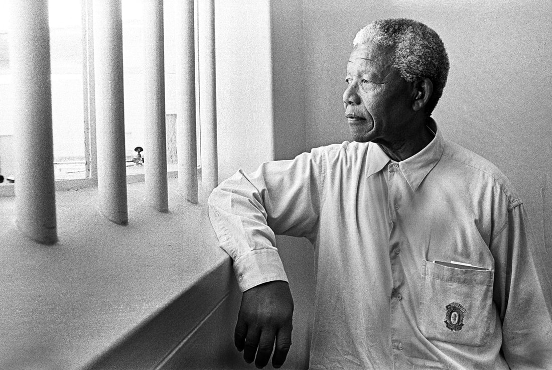
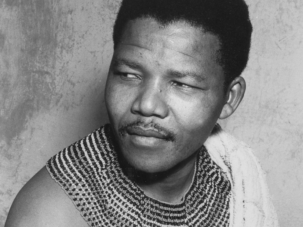
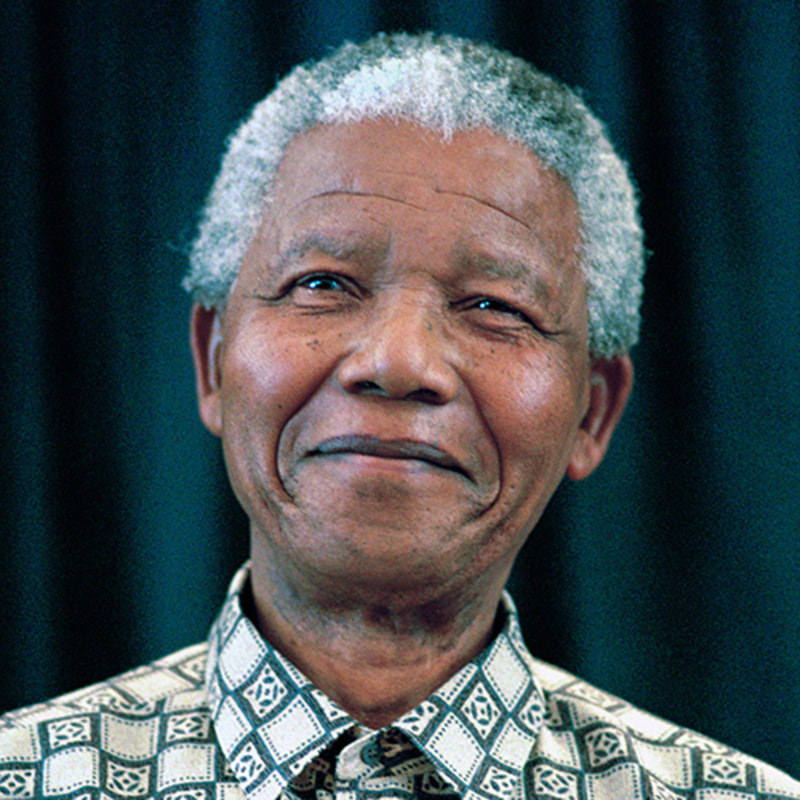
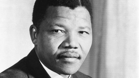
Today we are going to look at Centrifugal and Centripetal Forces and consider the consequences of such forces on a state. We are also going to look at how individuals can play a role in resisting and utilizing these forces to create a better state with the story of Nelson Mandela. Finally today we are going to work on a second one pager for the concepts of Unit 4.
Questions and thoughts to Ponder-
1. What are some examples of Centrifugal and Centripetal Forces in regards to state stability?
2. What are the consequences of Centrifugal and Centripetal Forces?
3. What is ethnonationalism?
4. Consider the impact of Nelson Mandela as a unifying force.
Terms, Places and People- centrifugal forces, centripetal forces, Regionalism, Ethnonationalism, Nationalism, Apartheid, Nelson Mandela, ANC, Robben Island, South Africa, Capetown, Johannesburg
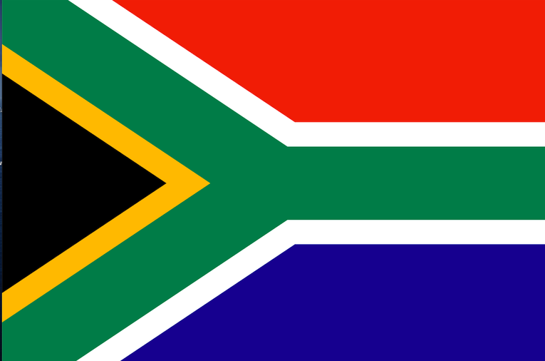
The design of South Africa’s new flag represented the unification of the diverse nation into one democratic state. The “Y” illustrates the convergence and the path ahead.
While officially there is no symbolism to the colors, some thoughts are that the red/orange, white and blue come from the British and Dutch colonial flags and the black, gold, and green are from the colors found in the flags of liberation groups, including Nelson Mandela’s ANC (African National Congress) party.
Possible theories-
- blue: the Atlantic and Indian Oceans or the wide sky overhead; truth, loyalty
- red: the bloodshed during the wars; bravery; strength
- green: fertility of the land; love, hope, and joy for the land
- yellow: the mineral wealth that is below the soil; gold
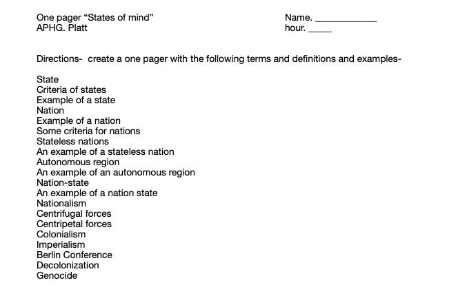
Assignment - State One pager Part 2 “Boundaries and theories” Name. _____________
APHG. Platt hour. _____
Directions- create a one pager with the following terms and definitions and examples-
Use your AMSCO Blue Book-
- (At least 5 illustrations on this one pager)
Defined boundary defined Gerrymandering defined and types-
Delimited boundary defined cracking defined
Demarcated boundary defined packing defined
Political boundaries defined stacking defined
natural boundary defined hijacking defined
natural boundary examples (3) kidnapping defined
geometric boundary defined
geometric boundary example (3)
cultural boundary defined
cultural boundary examples (3)
Types of Boundaries-
Antecedent defined/Antecedent example
Subsequent defined (ethnographic)/Subsequent example
Relic defined/Relic example
Superimposed defined/Superimposed example
Militarized defined/Militarized example
Day 13- Quiz and Workday / Catch Up Day 1-28-22 (ketchup day/for Patrick)

Today we will start by taking the Chapter 10 Quiz! This quiz is located on pages 264-266 in your AMSCO book. We will then review the Unit 3 test on Culture that we took as the final exam last December.
We will watch All African Countries Part 1- Label Map
Things to make sure you have completed today or over the weekend-
African Coloring Map
African Web Search
"States of Mind" One Pager
"Boundaries and Theories" One Pager
Kilimanjaro Sheet
Mystery of the Nile Sheet
For Others Check Powerschool.....
Have a Great Day and an Even Better Weekend!!!!
Day 14- Monday- What is the Heartland theory and what does it have to do with Political Geography? Plus more on All of the African Countries
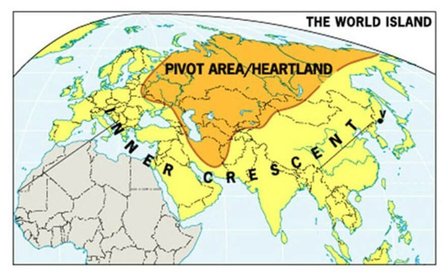
Today we are going to look at the Heartland Theory and the role it might have played in world political events. We are also going to continue our look at African Countries
Questions to Ponder?
1. What is the Heartland theory all about?
2. What makes up the "world island" and "out islands" in Heartland Theory?
3. What were some of the technological advances that influenced the "Heartland Theory"?
4. What is the influence of Geography on "Heartland Theory"?
Terms, People and Concepts-
Heartland, Rimland, Halford Mackinder, World Island, Outer Island, Pivot Area, Inner Crescent,
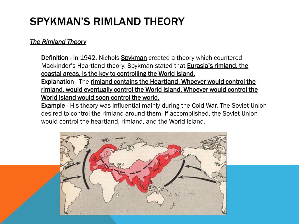
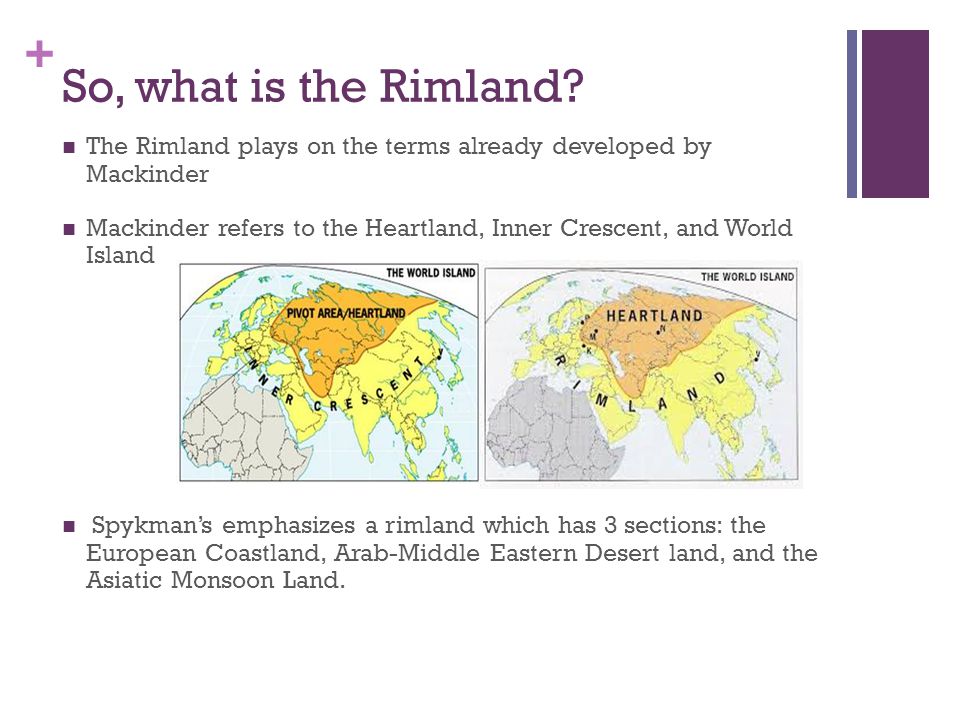
Day 15- Tuesday- What is the Rimland theory? Plus African Countries, Ground Hogs and More!!!!
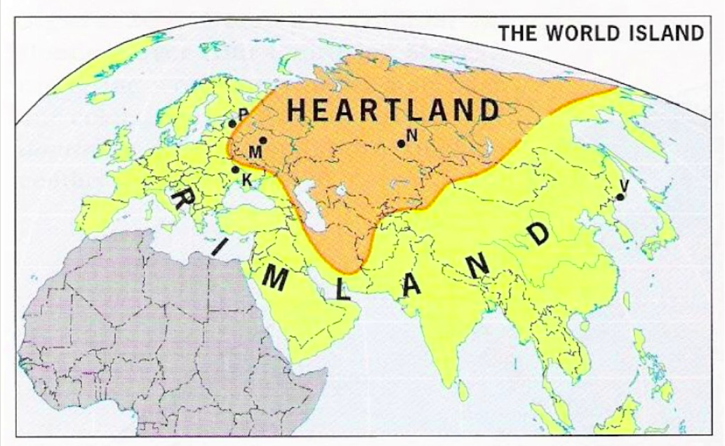
Today we are going to look at Spykman's Rimland theory and I want you to reflect on world events today and think about the ideas expressed in both the Heartland theory and the Rimland theory and any connections you might see.
Questions to Ponder-
1. What is a major difference between the Rimland Theory and the Heartland Theory?
2. Why did Spykman believe the Rimland was stronger than the Heartland? (3 reasons)
3. What area of the world would see the greatest among of conflict?
4. How might China be using this theory today?
5. Groundhogs????
6. What did you learn about African countries today?
KEY IDEAS- Rimland theory, Nichols Spykman, Eurasia, Heartland, Rimland, World Island, Soviet Union, Cold War, Mackinder, Buffer zone, Shatterbelts, 9 dash line.
When finished with our quick look at the Rimland Theory and "Every Country in Africa Part 3 " you need to be working on your Unit 4 vocabulary list slide show or any of your unfinished one pagers.
|
|
|

|
Day 16- Thursday- What is Organic Theory? plus Unit 3 FRQs, more African countries, and much much more! 2-3-22
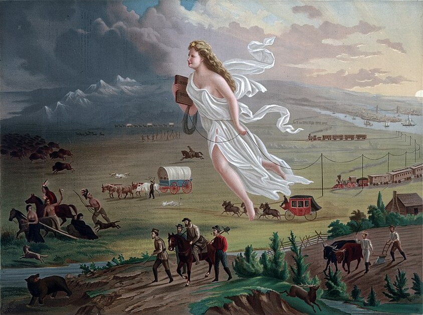
Today we are going to look at Ratzel's Organic Theory and historical examples such as Manifest Destiny that demonstrate or at the very least rationalize the theory.
Questions to Ponder-
1. What is the general idea of Friedrich Ratzel's Organic State Theory?
2. What ideas did Ratzel base his theory?
3. What are a couple of examples of the Organic State Theory?
4. What were some of the implications of Manifest DestinY?
Terms and Concepts-
Friedrich Ratzel, Organic Theory, World Power and Domination, Manifest Destiny
Unit 3 FRQ answers
- Cultural values and traditions help people develop a sense of place where they live. As globalization increases, various cultures come in contact with each other, resulting in a variety of processes and impacts.
A- Define the concept of Cultural Landscape
Cultural landscape is the modification of the environment by a group and is a visible reflection of that group's cultural beliefs and values. For example- signs reflect language, and places of worship reflect religions traditions, Cultural landscape is sometimes referred to as the built environment.
B- Define the concept of globalization
Either definition is correct-
- the process of intensified interaction among peoples, governments and companies for different countries from around the world
- the increased integration of connectivity of the world economy
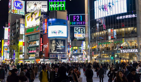
C- Using the image of Tokyo, Japan, describe an element of the photo that illustrates globalization
Any of the following is correct-
- multinational company signs such as Starbucks, Forever 21, Mastercard, Visa, Time etc...
- both Japanese and English are used
- clothing includes Western style suits and hats
- signs that show musicians, models and international personalities
- image looks similar to Time Square or large cities in other countries
D. Explain the diffusion of popular culture using the concept of hierarchical diffusion.
Must include a claim and specific details related to Hierarchical Diffusion. You must answer why a pattern is occurring.
- Hierarchical diffusion occurs when traits spread or leapfrog from one important person, influencer, city or powerful class
- Popular culture often spreads from one big city to another. This can be sped up using social media or the internet.
- An example will strengthen the answer- For example, Starbucks is an American company, but it has spread to other countries
and cities in the world that have the wealth to afford the coffee or the food.
- Other examples are acceptable as long as they illustrate the concept of hierarchical diffusion.
E. Explain how traditional cultures most commonly diffuse
Must include a claim and specific details related to how traditional cultures diffuse:
- Relocation diffusion occurs when people move from one place to another and take their culture with them such as religion beliefs
- Contagious diffusion occurs when oral traditions are passed down through stories or music- Irish music and dance
- An example to illustrate will strengthen the response. Stating that culture spreads slowly helps the response but is not enough for full credit
F. Explain how global culture is threatening to traditional folk cultures
Any one of the following will be awarded credit, as long as it accurately describes the threat. Better answers will include an example but are not required- (unless the description is weak)
- popular culture emphasizes trying what is new rather than preserving what is traditional.
- Young people often adopt global popular culture and do not adopt traditional culture which can result in the extinction of the traditional
culture
- Traditional culture is usually found in rural areas, but people often move to urban areas that usually emphasize popular global culture
for jobs to survive
- increased use of the internet (global culture) often challenges the beliefs or traditional oral traditions
G. Identify the scale of analysis of the image shown and describe a limitation of the image related to the scale.
Answers must accurately identify the scale and describe a limitation of the image.
Any one of the following is correct scale: Local, city, neighborhood
Any one of the following limitations of the image related to the scale is correct:
- image only shows one neighborhood and not a wider area such as the city of the country
- the time of day, month, or year the image was taken may influence who appears in the image. They can misrepresent the overall city, neighborhood or country
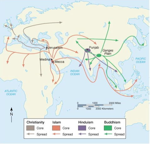
Two major religion hearths in the world are Southwest Asia (Middle East) and South Asia (area near India). Religions diffused from these regions too many others. Use the map to help answer these questions:
A. Identify ONE religion that originated in Southwest Asia (Middle East) and a country today where the majority of people follow that religion.
any of the following responses will earn credit-
- Judaism is dominant in Israel today
- Christianity is dominated in Europe, North America, South America, Australia, and New Zealand
- Islam is dominant in North Africa, the Middle East, Bangladesh, and Indonesia
B. Identify ONE religion that originated in South Asia and a country in the world today where the majority of people follow that religion
any of the following will earn credit
- Hinduism is dominat in India
_ Buddhism is dominant in Mongolia, Myanmar, Thailand, Laos, Cambodia, and Vietnam
C. Describe the ways universalizing and ethnic religions differ
any of the following comparisons can be used to earn credit
- Recruitment- Ethnic religions rarely recruit members because they are typically born into an ethnic religion while universalizing
religions generally actively seek converts
- Diffusion: Ethnic religions generally spread via relocation diffusion while universalizing religions can spread via relocation or
expansion diffusion
D. Explain how hierarchal diffusion helped the spread of Christianity
Any of the following responses will earn credit
-Leaders convert and citizens follow. When the leader or a country or empire chose to follow Christianity, the population of the
region would increasingly convert to Christianity. The Roman Empire under Constantine is an excellent example.
- Imperialism and colonialism are cause of diffusion. WhenEuropean explorers or empires conquered new lands, Christianity
usually became the official religion of the region. Examples include but are not limited to Spain, Portugal, England and France.
E. Describe how relocation diffusion explains the spread of either Hinduism or Judaism
Any of the following responses will earn credit:
-Judaism was spread primarily through relocation diffusion, such as through the Diaspora, the emigration of Jews from Europe to
the United States, and the migration of Jews from around the world to Israel
- Hinduism was spread primarily via relocation diffusion. Many people moved from South Asia to other parts of the British Empire
(particularly England and South Africa), and to other parts of the world (particularly Cambodia, Indonesian islands such as Bali, East
Africa, and the United States)
F. Identify the scale of analysis of the map shown and describe ONE limitation to the map
Answers must accurately identify scale and describe a limitation of the map-
Any one of the following is the correct scale- Eastern Hemisphere, Continental, almost global, global regional, world regional, regional
Any one of the following limitations of the image related to scale is correct:
-the map only shows Eastern Hemisphere and not the entire world
-the map does not show time, dates or quantitative data
-the map dose not show zoomed in patterns for individual countries or regions
-the map excludes different branches of each faith and or many other religions of the world
G. Describe one specific way that when a religion diffuses to a new area it can change the cultural landscape
Any of the following responses will earn credit-
- religious structures; new and existing buildings are used for religious activities
-Customs, beliefs or practices (behaviors): new ideas, symbols , beliefs or values are brought to an area and new festivals, holidays
or housing begin to appear within communities.
- Food: New types of food or even restrictions of foods may start to appear at markets or restaurants
- Multiculturalism: a diversity of cultures and beliefs appear in the cultural landscape
Africa Web Search (random facts) Name ______________
Class- World Geography Hour ________
Instructor- Mr. Platt Date _________
Directions- Go to the African links section of the World Geography page on Mr. Platt’s Web page- www.explorelearnteach.com. Go to the resources and links banner and look for “Africa” button. Find the “random African facts” button and follow the link to answer the following questions.
1. How much (by %) of earth’s total land area does Africa occupy? _________ (2)
Where does this rank the continent in size: _____
2. How many countries are there in Africa? ________ (14)
3. What two countries can you find the world’s largest frog: (37) what is its name? _________
A. __________________ B. ________________
4. What percentage of the world’s population does Africa represent _________. (3)
5. How many languages are spoken in Africa : >_______________. (range) (12)
6. What country do you find tigers in Asia or in Africa or both? _____________.(34)
7. What percentage of the world’s birds do you find in Africa? ______________. (11)
8. What is the deadliest animal in Africa? _____________.(30)
9. What percentage of Africa’s illiterate people are women? _______________. (5)
10. Where does Lake Victoria rank I the world by size for fresh water lakes? _____.(15)
11. How does the Sahara desert compare in size to the continental US? ________________.(41)
12. What country in Africa has the most pyramids? ____________. (be careful on this one) (17)
13. Four of the five fastest animals in the world live in Africa- they are: (18)
a. _________ b. ___________ c. ____________ d. ___________
which is the fastest: ____________ how fast do they run __________.
14. What African county was used for the scenes of Tatooine in Star Wars? _______________. (20)
15. What did Charles Darwin speculate about Africa ___________________________________. (21)
Why was his idea not accepted _____________________________.
16. Where was half of the world’s gold mined from? _____________. (40)
17. In Latin “Africa” means: ____________. (26)
18. In Greek “Aphrike” means; ____________________.(26)
19. Only two African Nations have NOT been under European colonial power they are: (13)
a. _________________ b. _________________
20. How much more per year do Africa women work more than men________________.(33)
21. What is the largest war in African history? ____________ (32)
How many died (estimated)? ___________
22. How can the second largest continent have the least amount of coastline? __________________________________________________________________________.(29)
23. What are the two most popular religions in Africa? (28)
a. _________________ b. ___________________
24. Africa is the poorest continent on the planet. The average person in sub- Saharan Africa makes
Just _______ (per day) go back to fact #4
25. ________ % of all the malaria cases in the world happen in Africa (fact #9)
26. Where did the name Africa come from __________________________________________. Fact #24
27. Who is “Lucy” form Ethiopia? _________________________________________________ Fact #23
28. Look at fact #16- What is the biggest tourist destination in Africa ____________________________.
29.how many people are malnourished in Sub-Saharan Africa? _______________
__________________________________________________________ (fact #49)
30. (fact #48) what is the world’s largest reptile? _____________________________.
Day 17-Monday- More of Africa and what are the FRQs for Test 4? 2-7-22
Today we are going to continue our look at African countries and Unit 4 Political Use of Space. I am going to give you the two FRQs so you can begin to plan and outline the questions. They are from your AMSCO book and can be found on pages 216 and 242. They are also written below-
#1- After 1945 many of the countries in Africa won their independence. Today, independent states are the primary building block of not just Africa but the entire world. Use the map to answer the questions below-

A- Identify TWO characteristics of a state.
B. Explain the difference between a nation and a state
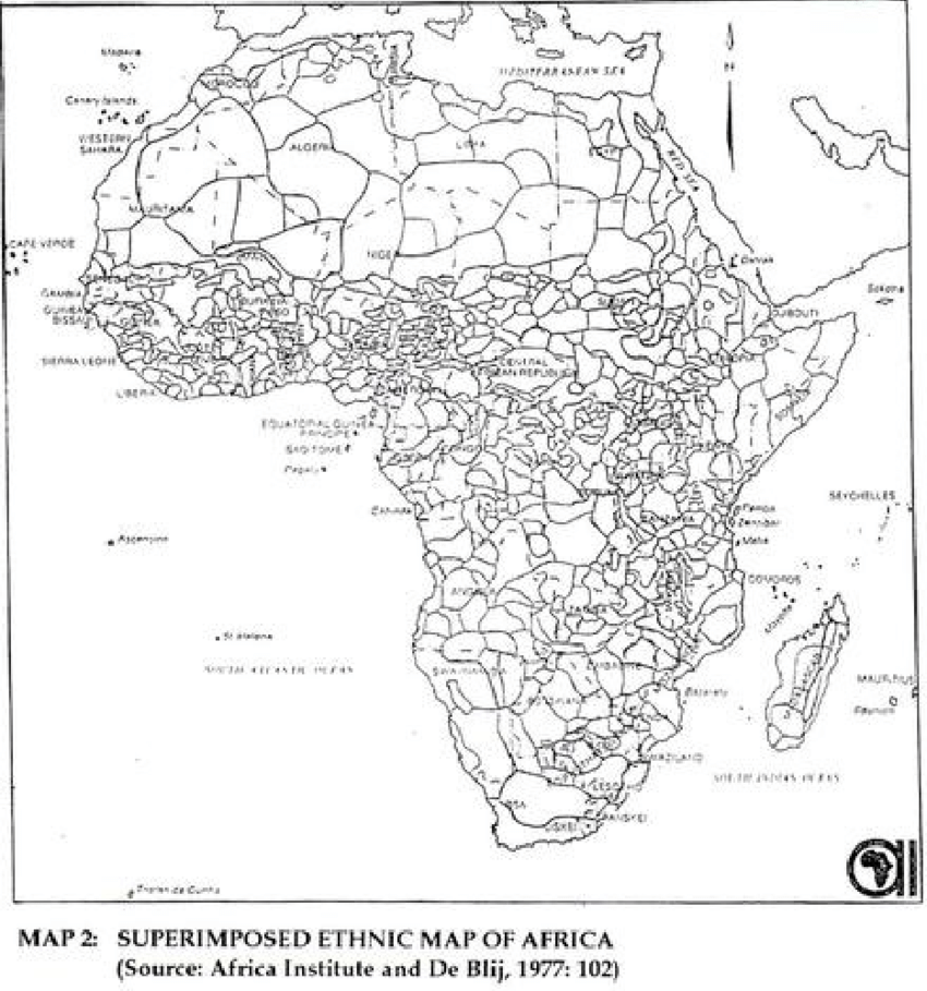
c. Explain the role that imperialism played in creating the borders of modern Africa.
D. Identify a county in Africa that had a civil war after 1945, and explain on centrifugal force that cased the conflict (2points)
E. Define the concept of a stateless nation and provide a real world geographic example.
G. Describe ONE example of a multistate nation.
B. Explain the difference between a nation and a state
c. Explain the role that imperialism played in creating the borders of modern Africa.
D. Identify a county in Africa that had a civil war after 1945, and explain on centrifugal force that cased the conflict (2points)
E. Define the concept of a stateless nation and provide a real world geographic example.
G. Describe ONE example of a multistate nation.
FRQ 2
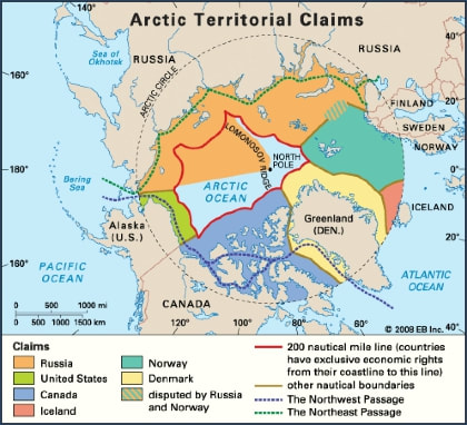
#2 Boundaries serve a variety of purposes and exist at the International, national and local scale. Territoriality is the willingness of a person, goup, or country to defend their claimed space. often claims of space can cause disagreements or even conflict. The United Nations Convention of the Law of the Sea (UNCLOS) defines the fights and responsibilities of nations. Use the two maps below to answer the questions below.
|
|
A. Define the concept of Territorial Seas as used in UNCLOS.
B. Describe what activities can occur in the Exclusive Economic Zones (EEZ) as used in UNCLOS.
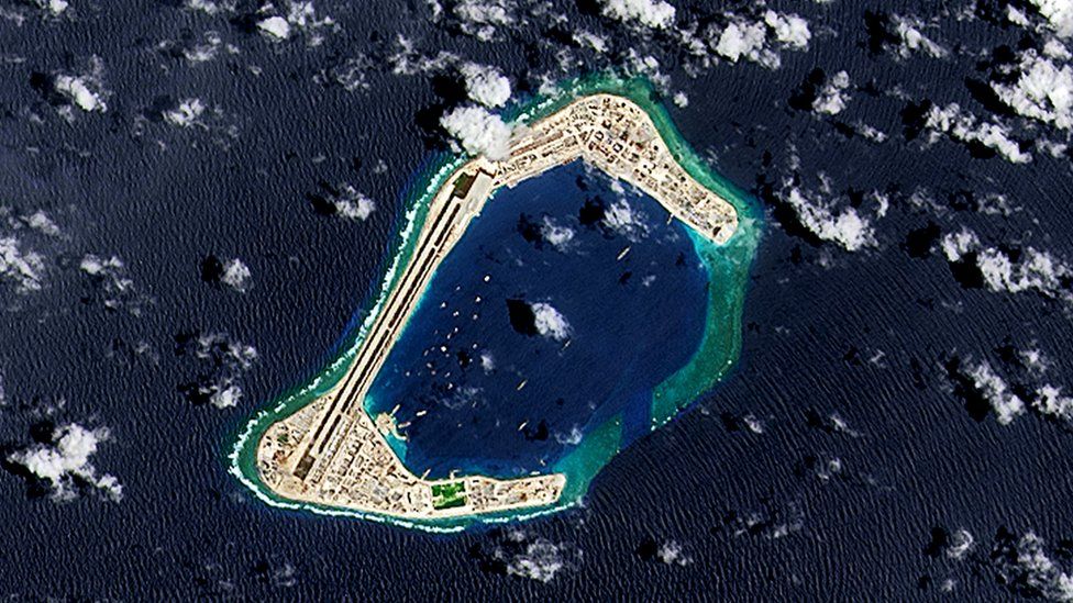
C. Using one the maps, identify TWO countries that have competing claims in the Arctic Ocean or the South China Sea.
D Describe TWO economic reasons that explain the important of the claims in the South China Sea or Arctic Ocean..
E. Describe ONE environmental concern affecting the oceans.
F. Describe ONE economic or environmental benefit of the Arctic Ocean for any country not shown on the map.
G. Briefly explain why choke points are politically or economically important.
B. Describe what activities can occur in the Exclusive Economic Zones (EEZ) as used in UNCLOS.
C. Using one the maps, identify TWO countries that have competing claims in the Arctic Ocean or the South China Sea.
D Describe TWO economic reasons that explain the important of the claims in the South China Sea or Arctic Ocean..
E. Describe ONE environmental concern affecting the oceans.
F. Describe ONE economic or environmental benefit of the Arctic Ocean for any country not shown on the map.
G. Briefly explain why choke points are politically or economically important.
Day 18- Tuesday- Test day practice, more African Countries and Country Map

Today we are going to take the practice test and then look at African Countries Part 6- We will most likely finish that video on the block day. Here is the list of the countries and physical features you will need to know for the test on Thursday-
Countries:
Morocco, Algeria, Libya, Egypt, Tunisia, Ethiopia, Sudan, South Sudan, Chad, Mali, Liberia, Cote D'Ivoire, Ghana, Nigeria, Somalia, Cameroon, Democratic Republic of the Congo, Kenya, Tanzania, Mozambique, Zimbabwe, Botswana, Namibia, South Africa , Madagascar,
Physical Features-
Atlas Mountains. Mount Kilimanjaro, Nile River, Blue Nile, White Nile, Gulf of Guinea, Mozambique Channel, Great Rift Valley, Niger River, Congo River Basin, Lake Victoria, Lake Chad, Sahara Desert, Victoria Falls, Cape of Good Hope
Day 19- Thursday- TEST DAY!!!! and more African Countries. 2-10-22

Today we look at our final set of African Countries while taking notes of the key features we enjoyed from the clips. Then you will take your group test complete with the African Maps section. Finally you will have time to work and take notes on your FRQs for Friday.
Have Fun and Good LUCK-
African Countries on today's video- Chad, Namibia, Burundi, Malawi, Mauritania, Angola, Gabon, Sierra Leone
Have Fun and Good LUCK-
African Countries on today's video- Chad, Namibia, Burundi, Malawi, Mauritania, Angola, Gabon, Sierra Leone
Friday- FRQ TEST DAY!!! 2-11-22